1859 |
1875 |
1895 |
1916 |
Old Plat
Maps of Center Line, Michigan
from 1859,
1875, 1895 and 1916
1859 |
1875 |
1895 |
1916 |
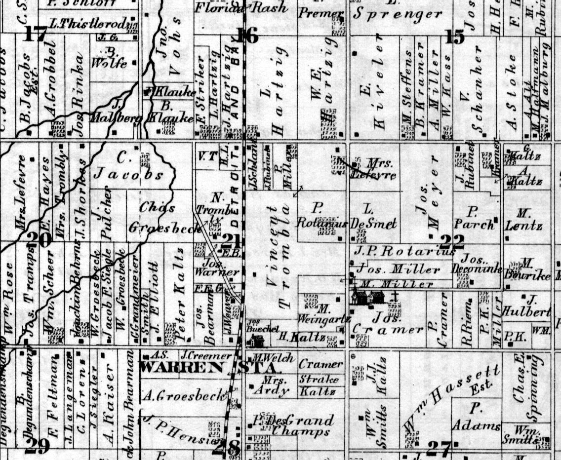
The intersection of
present-day Hoover and Stephens Roads is located in the lower
right corner of each of these images.
Clicking on an image will open an enlarged version in a new
window.

(click to enlarge)
This 1916 map shows the parcel ownership and subdivsion plats on the land either side of Van Dyke and north of Ten Mile Road.
Sources:
- 1859 Wall Map of St. Clair and Macomb Counties, Michigan (published
by Geil, Harley & Sevard)
- 1875 Atlas Map of Macomb County, Michigan (published by D.J.
Stewart of Philadelphia, Pennsylvania)
- 1895 Atlas Map of Macomb County, Michigan ( published by Geo. A.
Ogle & Co. of Chicago, Illlinois )
- 1916 Standard Atlas of Macomb County,
Michigan (published by Geo. A. Ogle & Co.)
Return to the Center Line Historical Information page